|
|
|
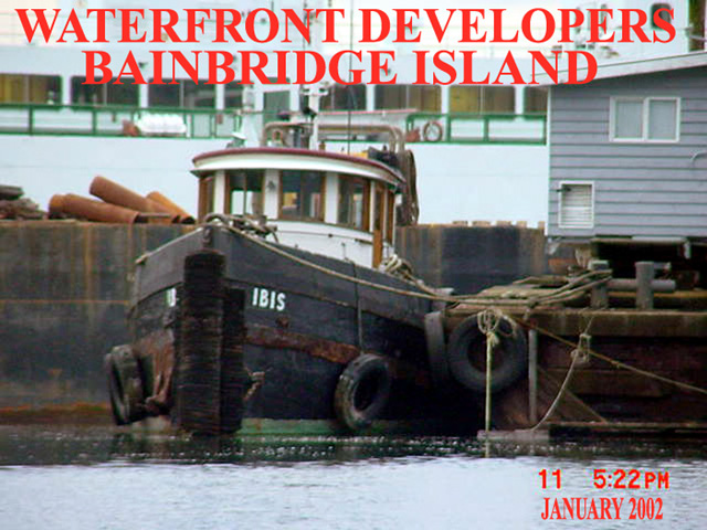
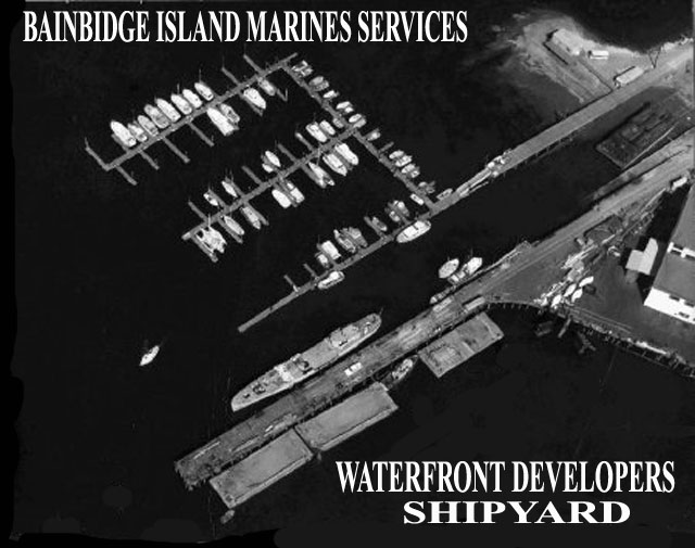
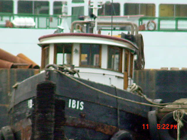
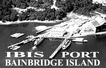
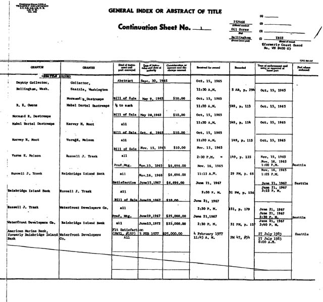
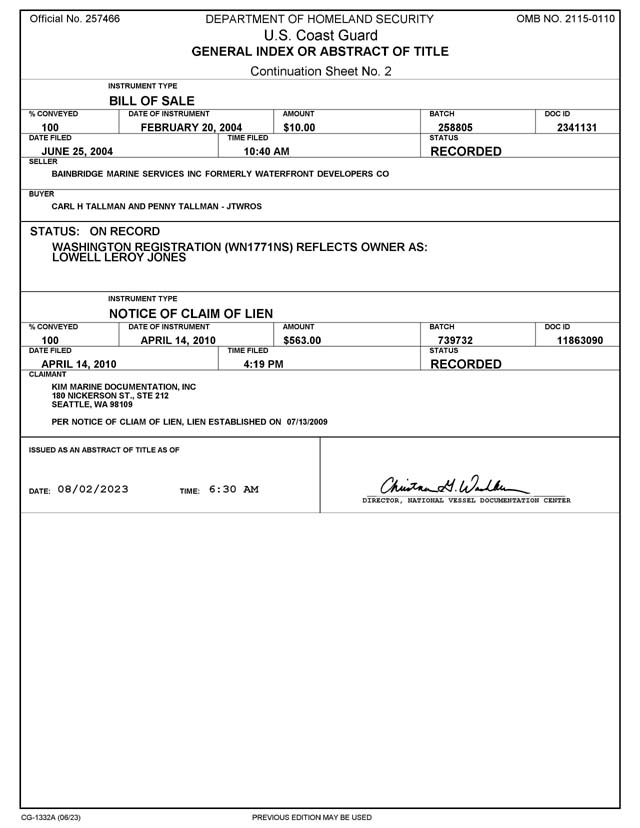
BAINBRIDGE MARINE SERVICES
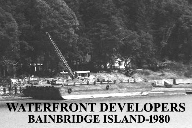
WATERFRONT DEVELOPERS
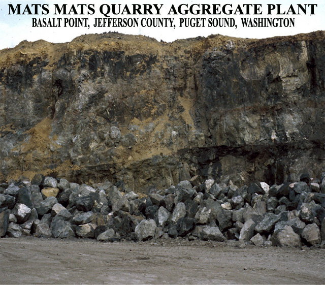
Mats Mats Quarry, Jefferson Co., Washington, USA
Latitude: 47° 57' 21" N Longitude: 122° 40' 57" W Bearing: 327.5° (NNW)
MATS MATS QUARRY NAVIGATION AIDS
US Geological Survey Topo Map
MATS MATS QUARRY HISTORY
DNR: Road Building Sands and Gravels of Washington
Basalt Rubble mound breakwater is one of the most important coastal engineering structures for shore and harbor protection. Rocks can come in all shapes and sizes, is another natural way to stabilize bank and protect from erosion. It can be done with minimal materials and equipment on the beach General Construction started basalt mining operations at Mats Mats in about 1934; the quarry was one of only two rock quarries on Puget Sound with water access (DNR: Mineral Resources of Washington . Lone Star Northwest bought the quarry in 1995. During the 1990s, as much as 500,000 tons of rock were mined a year, used for road projects, landscaping, preventing erosion , and as harbor breakwaters , seawalls, riprap, bulkheads. Residential neighbors formed the Mats Mats Area Coalition and complained about fly rock and noise from blasting operations, and were concerned that deep mining would harm the local freshwater aquifer. Lone Star wanted to mine to 30 feet below sea level, with a potential permit request to go 60 feet below the zero tide plane. Lone Star sold to Glacier Northwest, currently ownership CalPortland Mats Mats Aggregate Plant but it has apparently not been the site of any rock blasting since about 2005. The quarry’s permit remains active. Mats Mats Quarry site is zoned as a “mineral land of long-term significance,” according to the county’s comprehensive plan. The quary mine has a surface mining permit and a reclamation plan filed with the state Department of Natural Resources. Presently, “spoils” piles on the quarry peninsula are 120 feet above sea level, to be reduced during reclamation. Once quary mining operations are complete and the land is reclaimed, the plan calls for the property to be rezoned to rural residential
|
|
| 
Distance To Ports Finder |
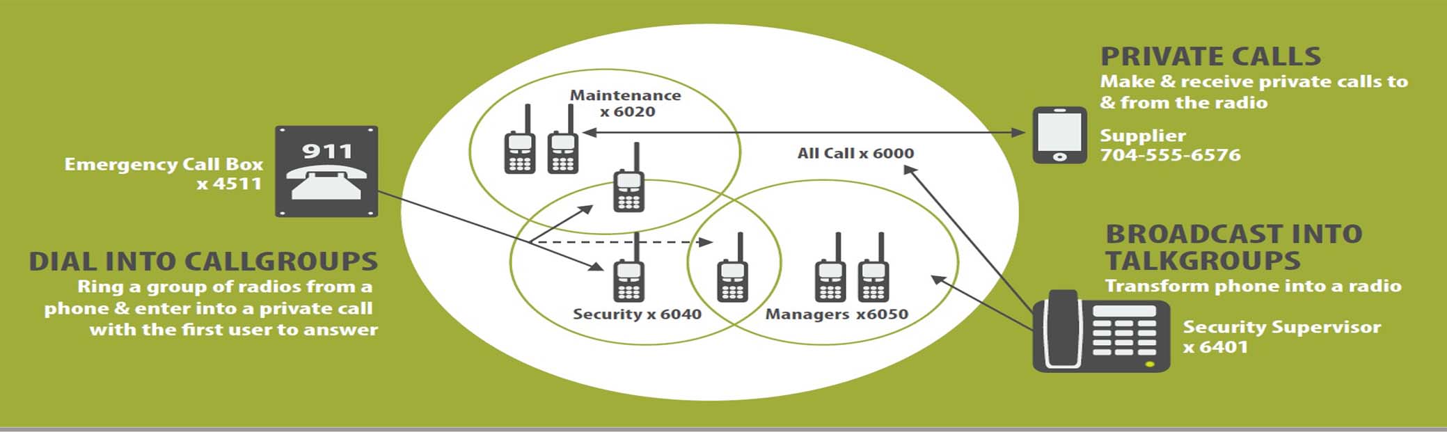
Radio Channels |
Vessel Traffic |
VHF Procedures |
Channels/Frequencies |
Puget Sound Nautical Chart |
Mats Mats Quarry Yard |
Basalt: Aphanitic Extrusive Igneous Rock |
Basalt Point Map |
Vessel Tracking |
PSIX Search |
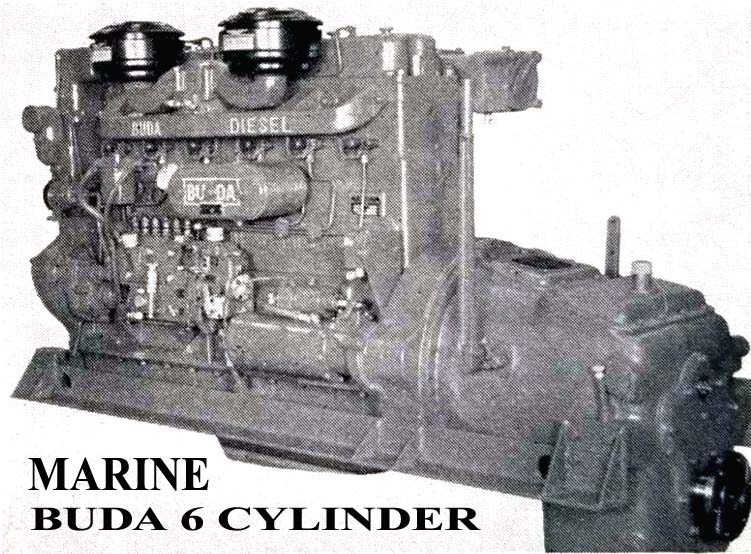
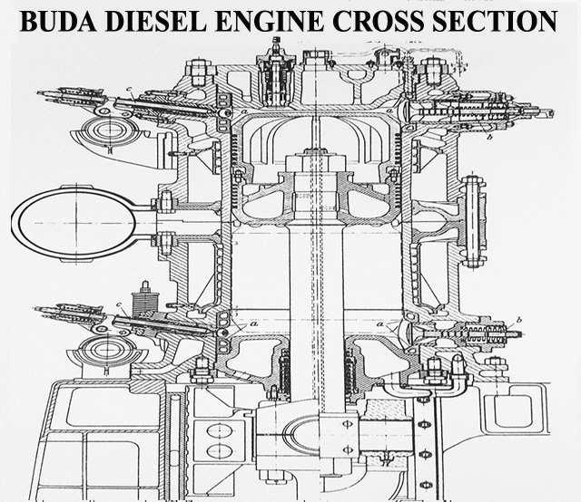
Buda Engine Company |
Marine Radio Operator Permit |
Maritime Identification Digits |
Ship Station |
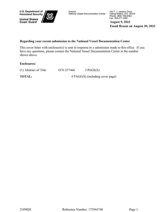
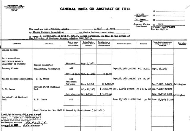
USCG: Vessel Documentation |
FCC: Ship License Search |
FCC: License Search |
Maritime Mobile Service Identity |
Maritime Mobile Service Identities - MMSI |
USCG Radio Frequencies |
Maritime Directory Links |
VHF/UHF/SSB Telephone Interconnect |
Radiotelephone History |
Marine SSB/Amateur Radio Frequencies |
FCC: Ship Radio Sations |
| 
| ||||||||||||||||||||||||||||||||||||||||||||||||||||||||||||||||||||||
| Online: Navigation Chart Locator | W5CGC: US Coast Guard Amateur Radio Club | Radiotelephone Handbook | Commercial/Restricted Permits License Search | General Radiotelephone Operator License | USCG: Navigation Standards Manual | FCC: Commercial Radio License Examinations | Ship Navigation Techniques | Navigation Seamanship Manual | USCG: Navigation Rules | PAYGOV: USCG Vessel Documentation Form | . | |||||||||||||||||||||||||||||||||||||||||||||||||||||||||||||||||||||||||||||||||||||||||
|
|
|
|
|
|
|
|
|
|
|
![Power By ETS]](http://www.atdlines.com/images/power.gif)

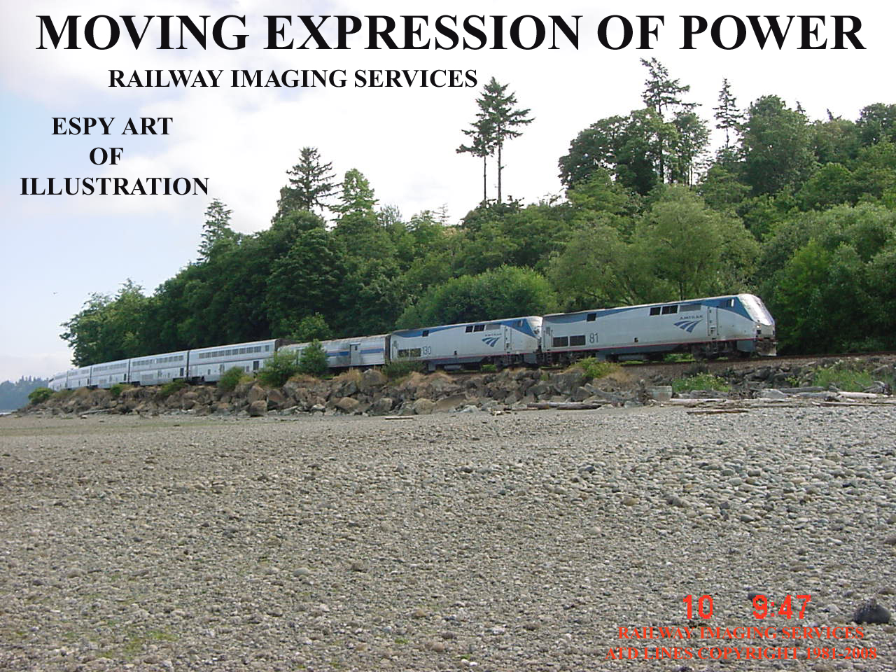
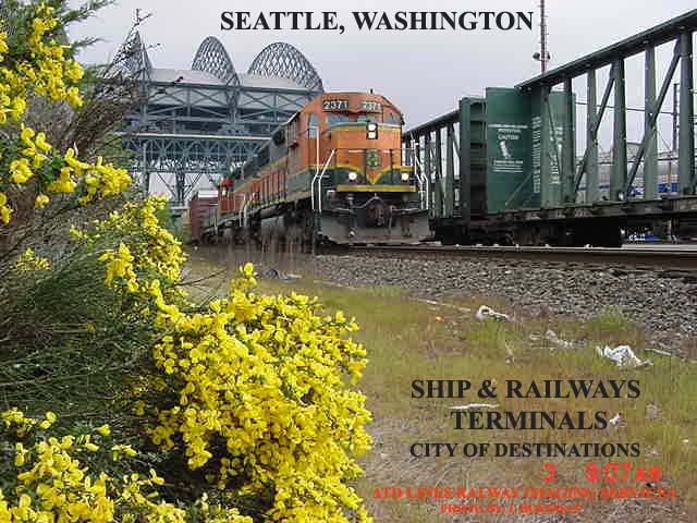
 AMERICAN TRAIN DESTINATION LINES
RAILWAY CITY ITINERARY PLANNING SERVICES
BAINBRIDGE ISLAND MARITIME HISTORICAL SOCIETY
All Inquires submitted To: atdlines@usa.com 206-780-6885
AMERICAN TRAIN DESTINATION LINES
RAILWAY CITY ITINERARY PLANNING SERVICES
BAINBRIDGE ISLAND MARITIME HISTORICAL SOCIETY
All Inquires submitted To: atdlines@usa.com 206-780-6885
![[Email Us]](http://www.atdlines.com/images/mailbutn.gif)
![[Return to Top]](http://www.atdlines.com/images/up.gif)
![Crossing Gate]](http://www.atdlines.com/motion/train6.gif)